The Peak and the Lake
Manimahesh Kailash is a peak of around 5,650 metres in the Pir Panjal range, in Bharmour tehsil, Chamba district, Himachal Pradesh.
Below it, at about 4,080 metres, lies Manimahesh Lake, and the yatra to that lake is the principal pilgrimage of the Chamba region.
The claim:
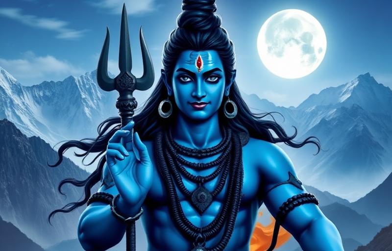
- The peak is understood as an abode of Shiva, one of several Kailashes recognised in the Himalaya
- It is regarded as unclimbed
- Tradition holds that anyone attempting the summit will be prevented, and stories describe attempts that failed
- The mani, the jewel on Shiva's crown, is said to flash from the peak, visible on clear nights, which gives the mountain its name
What is verifiable:
- There is no recorded successful ascent of Manimahesh Kailash
- Climbing is not permitted and is not attempted
- The mountain is not technically among the harder peaks of its height in the region
That combination is the interesting part. This is not an unclimbed peak because it is impossible. It is unclimbed because nobody climbs it.
Unclimbed sacred peaks. Manimahesh belongs to a small and shrinking category.
- Mount Kailash in Tibet, the most famous, never climbed, and approached only by circumambulation
- Machhapuchhre in Nepal, closed to climbing by decree after a 1957 expedition stopped short of the summit at the request of the authorities
- Gangkhar Puensum in Bhutan, the highest unclimbed mountain in the world, closed by law
- Kangchenjunga, where climbers by convention stop short of the actual summit out of respect for Sikkimese belief, a practice begun by the 1955 first ascent party
- Nanda Devi in Uttarakhand, closed since 1983, though it has been climbed
Why this matters. Mountaineering is one of the few human activities whose entire purpose is to stand on top of something.
A culture that says a mountain must not be stood on is making a claim that runs directly against that, and it is worth taking seriously rather than treating as an obstacle to be negotiated.
The Kangchenjunga precedent is the most interesting version, because it is climbers themselves who chose to observe it. The 1955 party promised the Chogyal of Sikkim they would leave the summit untrodden, and parties have largely honoured it since, seventy years later, with no enforcement of any kind.
The Yatra
When. The yatra is held around Radhashtami, in the month of Bhadrapada, generally late August or September.
- The season opens around Janmashtami and culminates at Radhashtami
- The window is short, roughly a fortnight to three weeks
- Outside that period the route is not managed and the lake is generally inaccessible or under snow
The route from Hadsar. This is the standard route and the one most yatris take.
- Chamba to Bharmour, about 65 km by road
- Bharmour to Hadsar, about 13 km by road, and Hadsar is the roadhead
- Hadsar to Dhancho, about 6 km on foot, climbing gradually alongside the Manimahesh stream, with a waterfall at Dhancho
- Dhancho to Sundrasi and Gaurikund, steeper, about 7 km
- Gaurikund to Manimahesh Lake, the final stretch
- Total roughly 13 to 14 km each way from Hadsar, with an ascent of around 1,300 metres
The Kugti or Holi route. A second, considerably harder approach comes from the Holi side in Bharmour tehsil, crossing higher ground. It is used by fewer yatris and by Gaddi shepherds.
What happens at the lake:
- Yatris bathe in the lake, or in Gaurikund below it, which is the customary bathing place for women, with Shiv Karotri for men
- Parikrama of the lake is performed
- Offerings are made
- A Chhari Yatra, a processional pilgrimage carrying a holy mace, comes from Bharmour and is the ceremonial centre of the event
- Many yatris stay for the night at the lake or at Gaurikund and complete the rites at dawn
The Chhari Yatra. The formal procession sets out from Bharmour and travels the route to the lake, and its arrival marks the culmination.
It is accompanied by a large body of pilgrims and by the Gaddi community, and following the chhari rather than walking independently is what many yatris do.
Scale. Numbers vary considerably by year and by weather, but the yatra draws pilgrims in the tens of thousands, and in some years considerably more, over the short season.
Facilities. Temporary arrangements are made for the season.
- Langars, free community kitchens, are run along the route by voluntary organisations
- Tents and basic shelter are available at Dhancho and near the lake
- Medical posts are established at points on the route
- Helicopter services have operated in some years between Bharmour and Gaurikund, subject to weather and to availability
Outside the season none of this exists, which is the single most important practical fact about the route.
Altitude, and Taking It Seriously
The lake is at about 4,080 metres and people die on this yatra every year, almost always from causes that are preventable. This section is the most important in this guide.
What altitude does:
- Air pressure falls with altitude, so each breath delivers less oxygen
- The body compensates, but the adjustment takes days, not hours
- Ascending faster than the body can adjust produces acute mountain sickness
Acute mountain sickness, AMS:
- Headache, which is the cardinal symptom
- Nausea, loss of appetite, vomiting
- Fatigue out of proportion to the effort
- Dizziness
- Poor sleep
The rule. If you have a headache at altitude, assume it is AMS until proved otherwise. Do not go higher.
The two dangerous progressions:
HAPE, high altitude pulmonary oedema, fluid in the lungs:
- Breathlessness at rest, which is the key sign
- A cough, which may produce frothy or pink sputum
- Chest tightness
- Very rapid deterioration
HACE, high altitude cerebral oedema, fluid in the brain:
- Confusion, altered behaviour, inability to think clearly
- Ataxia, loss of coordination, which is tested by asking the person to walk heel to toe in a straight line
- Severe headache not relieved by painkillers
- Drowsiness leading to unconsciousness
Both are fatal if untreated. The treatment for both is to go down.
The rules that save lives:
- Descend at the first sign of HAPE or HACE, immediately, at night if necessary, and do not wait for morning
- Never leave a sick person alone and never let them descend alone
- Never ascend with symptoms
- Descent of even 300 to 500 metres produces improvement
- Oxygen and medication help but do not replace descent
Specific advice for this yatra:
- Do not do it in one day from Hadsar if you can avoid it. Night at Dhancho
- Drink water continuously. Dehydration mimics and worsens AMS
- Do not drink alcohol
- Eat, even without appetite
- Walk slowly. Everyone who is going too fast thinks they are fine
- Watch the people you are with, since HACE affects judgement and the person with it will be the last to notice
Who should not go:
- Anyone with significant heart or lung disease without specific medical clearance
- Anyone with uncontrolled hypertension
- Pregnant women, on general medical advice about high altitude
- Anyone who has had HAPE or HACE before, without advice
- Very young children, who cannot report symptoms reliably
Talk to a doctor before going if you have any chronic condition. Acetazolamide is used for prophylaxis and treatment, but it is a prescription medicine and needs medical advice, not a recommendation from a guide.
Other hazards on this route:
- Cold. Temperatures at the lake fall below freezing at night even in September
- Rain. The yatra falls at the end of the monsoon and the route can be wet, slippery and prone to landslides
- Stream crossings and steep exposed sections
- Crowding on a narrow path
What to carry:
- Warm layers, including a proper insulating layer and a windproof outer
- Waterproofs
- Good footwear with grip, broken in beforehand
- Water and the means to refill
- A torch, since the final stretch is often walked before dawn
- Any personal medication, in your pocket and not in a bag carried by somebody else
A closing point on this section. The yatra is a devotional act and people undertake it in a spirit of endurance and offering, which is right and is the whole point.
Endurance is not the same as ignoring symptoms. Shiva is not asking anybody to die of pulmonary oedema on a footpath in Chamba, and going down when you are ill is not a failure of the vow.
The Gaddis
The Manimahesh yatra is inseparable from the Gaddi community, for whom this is a central observance.
Who the Gaddis are:
- A pastoral community of the Chamba and Kangra region, traditionally transhumant shepherds
- Their homeland is Bharmour, called Gadderan, and Bharmour is understood as the community's centre
- They keep sheep and goats, historically in large flocks
- They practise transhumance: moving flocks up to high pastures in summer and down to the lower hills and Punjab plains in winter
- They are Hindu, and Shiva is their principal deity, which is why Manimahesh is so central to them
Transhumance. The practice is worth understanding because it is one of the great sustainable land use systems and it is now under strain.
- Flocks move up as the snow retreats, following the grass
- They graze alpine pastures in the summer, land that cannot be cropped and would otherwise be unused
- They move down before the snow returns
- The routes are traditional, take weeks, and cross passes at high altitude
- The manure fertilises the pastures and the fields they pass through, and the arrangement historically involved payment or exchange with farmers along the route
Why it is under strain:
- Loss of grazing rights and access, including through the creation of protected areas
- Road building and development along traditional routes
- Younger generations taking other work, which is a rational choice
- Climate changes affecting snow line and pasture timing
- Wool prices and market changes
Gaddi dress. Distinctive and worth recognising.
- The chola, a long woollen coat
- The dora, a long black woollen rope wound many times around the waist, which serves as a belt, a rope and a carrying aid
- A topi, a cap
- Woollen blankets and footwear suited to the routes
Gaddi religion. Shaiva, with local features.
- Shiva as the principal deity, and Manimahesh as his abode
- Local deities and devta traditions shared with wider Himachali practice
- The Manimahesh yatra as the community's central pilgrimage
- Association with the Chaurasi temples at Bharmour
The Himachali devta system. Worth a note because it shapes religion across the state.
- Villages and valleys have their own devta or devi, a local deity with a defined territory
- The deity travels in a rath, a palanquin carried by devotees
- The deity speaks through a medium, the gur, and is consulted on real decisions
- Deities visit each other, attend fairs, and have relationships, rivalries and precedence disputes with each other
- The Kullu Dussehra brings hundreds of village deities together and is the largest expression of the system
This is a living institution, not a folk survival. Himachali village deities are consulted about marriages, disputes, illness and, in documented cases, about development projects.
A visitor to the state who understands only the big temples has missed most of what is actually going on.
The Five Kailashes
Manimahesh is one of several peaks in the Himalaya identified as Kailash, and the set is worth knowing.
The Panch Kailash, as generally listed:
- Mount Kailash in Tibet, the principal one, at 6,638 metres, circumambulated but never climbed
- Adi Kailash or Chhota Kailash, in Pithoragarh district, Uttarakhand, near the Indo Tibetan border
- Kinnaur Kailash, in Kinnaur district, Himachal, with a natural rock formation at the summit identified as a Shivalinga
- Shrikhand Mahadev, in Kullu district, Himachal, with a rock linga at around 5,200 metres reached by a very demanding trek
- Manimahesh Kailash, in Chamba, this one
Why there are several. This is a general feature of Indian sacred geography and it is not a case of confusion or competition.
- A sacred site is understood as a place where a reality is manifest, not as a unique physical location
- The same manifestation can occur in more than one place
- A local Kailash is not a substitute for the Tibetan one; it is Kailash, in that locality
- The same logic produces multiple Kashis, multiple Prayags and the Chinna Tirupati pattern described elsewhere
The practical dimension. Mount Kailash in Tibet requires travel to China, a permit, an organised group and considerable expense, and access has been interrupted for extended periods.
A Kailash within India that can be reached on foot from a roadhead in Himachal serves a devotee who is never going to get to the Tibetan one, and the tradition regards that as sufficient rather than second best.
The Kailash Mansarovar Yatra. Worth a note since it is the reference point.
- Organised routes through Uttarakhand via Lipulekh and through Sikkim via Nathu La have operated under government arrangements
- Private operators run trips via Nepal
- The circuit involves the kora or parikrama of the mountain, around 52 km, crossing the Dolma La at about 5,600 metres
- Lake Manasarovar is bathed in and circumambulated
- The yatra is physically demanding and the altitude warnings in this guide apply with considerably more force
- Access depends on the political relationship between India and China and has been suspended in some years
Shrikhand Mahadev deserves a warning. It is the hardest of the Indian Kailashes and is genuinely dangerous.
The trek from Jaon involves around 32 km each way with an ascent to about 5,200 metres, including a section over boulder fields and steep ground at altitude. People die on it regularly. It should not be attempted without genuine fitness, acclimatisation and, ideally, experience.
Kinnaur Kailash is also serious, with a very steep ascent from Tangling or Powari, and should be treated as a demanding high altitude trek rather than a pilgrimage walk.
Manimahesh's position among these is that it is the most accessible of the demanding ones and the most demanding of the accessible ones, which is why it draws the numbers it does and why the safety guidance matters.
Planning the Manimahesh Yatra
Getting to the start
- Bharmour, Chamba district, Himachal Pradesh, is the base
- Chamba to Bharmour, about 65 km by road
- Pathankot is the nearest major railhead, about 180 km from Bharmour
- Buses run from Chamba, and from Pathankot and Chandigarh to Chamba
- Hadsar is 13 km beyond Bharmour and is the roadhead
Registration. The state administration operates registration for the yatra in most years. Check the current requirement before travelling and register if required.
When
- The yatra period runs from around Janmashtami to Radhashtami, in Bhadrapada, generally late August into September
- Radhashtami is the culminating day and the most crowded
- Outside the season the route is unmanaged, unsupported and generally impassable
Suggested itinerary
Day one: Reach Bharmour. Visit the Chaurasi temples. Sleep at Bharmour, at about 2,200 metres, which begins acclimatisation.
Day two: Bharmour to Hadsar by road, then walk to Dhancho, about 6 km. Sleep at Dhancho.
Day three: Dhancho to Manimahesh Lake via Sundrasi and Gaurikund, about 7 km. Perform the rites. Either sleep near the lake or descend to Dhancho.
Day four: Descend to Hadsar and on to Bharmour or Chamba.
Doing it in two days is common and is how most yatris manage it. Doing it in one day from Hadsar is done and is a bad idea, for the reasons given in the altitude section.
Horses and porters. Ponies are available on the route to Gaurikund and porters can be hired. Rates are posted in most years. Note that riding does not protect you from altitude illness, since the problem is the altitude and not the effort.
Helicopter. Services have operated between Bharmour and Gaurikund in some years. They are weather dependent, frequently cancelled, and taking one means arriving at high altitude with no acclimatisation at all, which increases the risk of AMS considerably. If you fly up, be especially alert for symptoms.
What to expect
- A well trodden path with heavy foot traffic during the season
- Langars at intervals
- Basic tented accommodation
- Cold, wet conditions at any time
- Very large crowds around Radhashtami
Combining the visit
- Chaurasi temples, Bharmour, which should be visited as part of the yatra and are described separately
- Chamba town, with the Lakshmi Narayan temples and the Bhuri Singh Museum
- Khajjiar, between Chamba and Dalhousie
- Dalhousie
- Bharmani Mata temple above Bharmour, which is traditionally visited before the Manimahesh yatra
- Kugti and the upper Budhil valley, for Gaddi country
Bharmani Mata. Local practice holds that the Manimahesh yatra should be preceded by a visit to the Bharmani Mata temple above Bharmour, and that the pilgrimage is incomplete without it. It is a walk of a few kilometres from Bharmour and is worth doing on the acclimatisation day.
A closing thought. There is a mountain in Chamba that a moderately fit party with permission could probably climb in a few days.
Nobody has, because a community decided a very long time ago that it was not theirs to stand on, and everybody since has agreed.
In a century that has put people on top of every other significant summit on earth, that is a genuinely unusual thing to have held on to, and it is worth a moment's thought while you are standing at the lake looking up at it.
Quick Answers
Where is Manimahesh and how do I get there?+
Manimahesh Kailash is in Bharmour tehsil, Chamba district, Himachal Pradesh, with the lake at about 4,080 metres below the peak. Bharmour is the base, about 65 km by road from Chamba, and Hadsar 13 km further is the roadhead. Pathankot is the nearest major railhead about 180 km from Bharmour.
When is the Manimahesh yatra held?+
Around Radhashtami in the month of Bhadrapada, generally late August or September. The season runs from around Janmashtami to Radhashtami, a window of roughly a fortnight to three weeks. Outside that period the route is unmanaged and unsupported and the lake is generally inaccessible or under snow.
How hard is the trek?+
About 13 to 14 km each way from Hadsar with an ascent of around 1,300 metres to a lake at 4,080 metres. Do it over two days with a night at Dhancho rather than in one day. The altitude is the real difficulty, not the distance, and acute mountain sickness is the principal risk.
What are the signs of altitude sickness?+
Headache is the cardinal symptom of acute mountain sickness, with nausea, loss of appetite, fatigue out of proportion to effort and poor sleep. Breathlessness at rest with a cough suggests HAPE, fluid in the lungs. Confusion and loss of coordination suggest HACE, fluid in the brain. Both are fatal if untreated and the treatment for both is to descend immediately.
Has the peak ever been climbed?+
There is no recorded successful ascent. Climbing is not permitted and is not attempted, and the peak is not technically among the harder mountains of its height in the region, so it is unclimbed because nobody climbs it rather than because it is impossible. It joins Mount Kailash, Machhapuchhre and Gangkhar Puensum in that category.
Who are the Gaddis?+
A pastoral community of the Chamba and Kangra region, traditionally transhumant shepherds whose homeland is Bharmour, called Gadderan. They move flocks of sheep and goats up to alpine pastures in summer and down to the lower hills and Punjab plains in winter. Shiva is their principal deity, which is why Manimahesh is central to them, and the yatra is their main pilgrimage.
About the author
Pandit Ravindra Sharma · Vedic Rituals & Bhakti, 22+ years
Pandit Ravindra is the Vandnaa editorial team's resident specialist on aarti, chalisa, and daily devotion. He has performed home and temple pujas across Varanasi and Delhi for over two decades and contributes the bhakti-focused articles on this site.
Meet the Vandnaa editorial team →